Localities and Geology
The Cambrian Lagerstätten of Utah were laid down in an ancient environment very different from that of Utah today. During the Cambrian period, present-day Utah was positioned nearly at the equator and much of it was covered by an ancient ocean.
Rock units bearing exceptional preservation of soft-parts were deposited under very low to completely oxygen-free conditions. This prevented the soft-parts from being quickly decomposed by microbes and scavengers.
An illustration of the ancient "paleogeography" of North America (known to geologists as “Laurentia”) is provided below. This map shows the approximate position of Utah (red star) during the Cambrian, as well as the position of the famous Burgess Shale of British Columbia.
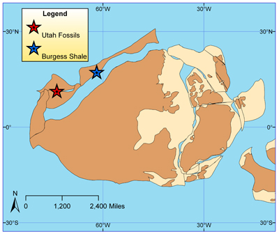
While the overall fossil record of Utah is great, Burgess Shale type preservation of soft-parts mostly occurs in just four Cambrian deposits:
- Spence Shale Member of the Langston Formation
- Marjum Formation
- Wheeler Formation
- Weeks Formation
In turn, individual sites of Burgess Shale type preservation within these four rock units are restricted to three mountain ranges:
- Wellsville Mountains (Box Elder County)
- House Range (Millard)
- Drum Mountains (Millard County)
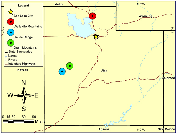
Wellsville Mountains, Box Elder County
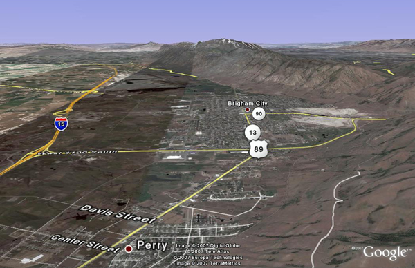
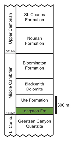
The Wellsville Mountains are located just east of Brigham City, Utah in Box Elder County. Burgess Shale type preservation occurs in one rock unit, the Spence Shale Member of the Langston Formation. The position of the Langston Formation relative to other Cambrian strata exposed in the Wellsville Mountains is shown below.
House Range, Millard County
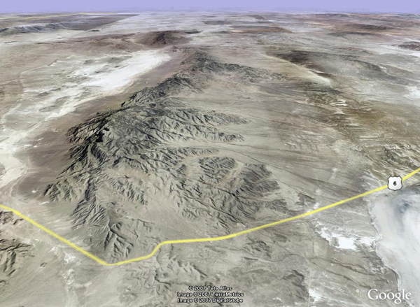
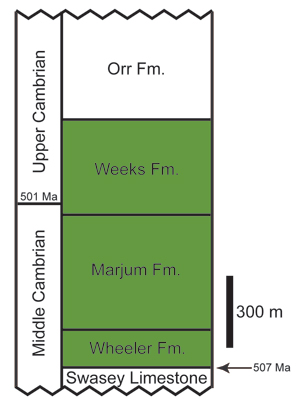
The House Range is located in Millard County, Utah. Within the House Range, Burgess Shale type preservation occurs within three rock units: the Wheeler Formation, the Marjum Formation, and the Weeks Formation. The stratigraphic positions of these three rock units are shown below.
Drum Mountains, Millard County
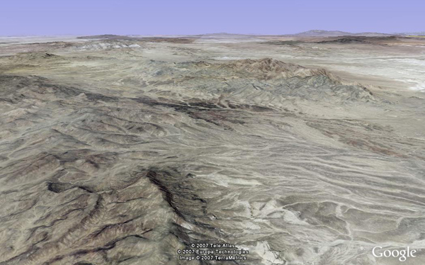
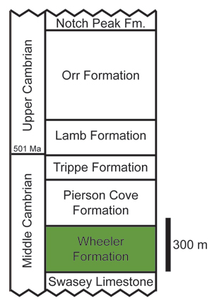
The Drum Mountains are also located in Millard County, Utah. Within the Drum Mountains, Burgess Shale type preservation occurs within the Wheeler Formation. A stratigraphic section showing the position of the Wheeler Formation relative to other rock units in the Drum Mountains is shown below.
To learn more about the geology of Utah, visit the Utah Geological Survery homepage.