Anomalocaridids
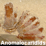 Anomalocaridids are one of the most charismatic groups of Cambrian animals. These swimming creatures were the largest Cambrian animals and were probably top-level predators. They had a dougnut shaped mouth (originally thought to be a jellyfish!) with two large grasping appendages on either side. For more information on anomalocaridids, visit the Smithsonian Institution's webpage about Anomalocaris.
We have chosen to group anomalocaridids with the arthropods on the basis of their sclerotized, segmented feeding appendages. While most paleontologists think that anomalocaridids are closely related to arthropods, some think that they represent a basal branch on the portion of the evolutionary tree containing the arthropods and therefore deserve their own phylum-level status.
Regardless of how one classifies anomalocaridids, they were remarkable animals and are well-represented in the Cambrian fossil record of Utah. While several genera of anomalocaridids have been described--especially from the Burgess Shale of British Columbia and the Chengjiang region of China--all specimens from Utah have been referred either to the genus Anomalocaris or the family Anomalocarididae.
Some have suggested that Pahvantia and Proboscicaris, both of which are classified here as bivalved arthropods, were actually parts of an anomalocaridid.
Gallery of Anomalocaridids
Note: Marks on all scale bars are centimeters (cm).
Anomalocaris sp. Whiteaves, 1892

KUMIP 314037. Spence Shale Member of the Langston Formation, Wellsville Mountains, Box Elder County, Utah. Figure 1.1 in Briggs & Lieberman et al. (2008).

KUMIP 314087. Wheeler Formation, House Range, Millard County, Utah. Figure 3.1 in Briggs & Lieberman et al. (2008).
Anomalocaris nathorsti (Walcott, 1911)

KUMIP 153093 (part, counterpart). Wheeler Formation, House Range, Millard County, Utah. Figure 1-4 in Conway Morris & Robison (1982).

KUMIP 153094. Wheeler Formation, House Range, Millard County, Utah. Figure 5 in Conway Morris & Robison (1982).

KUMIP 204777 (part, counterpart). Spence Shale Member of the Langston Formation, Wellsville Mountains, Box Elder County, Utah. Figure 26.1a, 26.1b in Conway Morris & Robison (1988).

KUMIP 204778 (part, counterpart). Spence Shale Member of the Langston Formation, Wellsville Mountains, Box Elder County, Utah. Figure 26.2 in Conway Morris & Robison (1988).

KUMIP 204779 (part, counterpart). Spence Shale Member of the Langston Formation, Wellsville Mountains, Box Elder County, Utah.

KUMIP 204780. Spence Shale Member of the Langston Formation, Wellsville Mountains, Box Elder County, Utah.

KUMIP 204781 (part, counterpart). Wheeler Formation, House Range, Millard County, Utah. Figure 26.3 in Conway Morris & Robison (1988).

KUMIP 314095 (part, counterpart). Marjum Formation, House Range, Millard County, Utah.
Anomalocaridae gen. et sp. indet. (genus & species unknown)

KUMIP 314078 (part, counterpart). Wheeler Formation, House Range, Millard County, Utah. Figure 2.1 in Briggs & Lieberman et al. (2008).

KUMIP 314086 (part, counterpart). Wheeler Formation, House Range, Millard County, Utah. Figure 2.2 in Briggs & Lieberman et al. (2008).